Industry News
Home / Company / News and Events / Industry News
Are drones the future of marine surveying?
2018-06-15
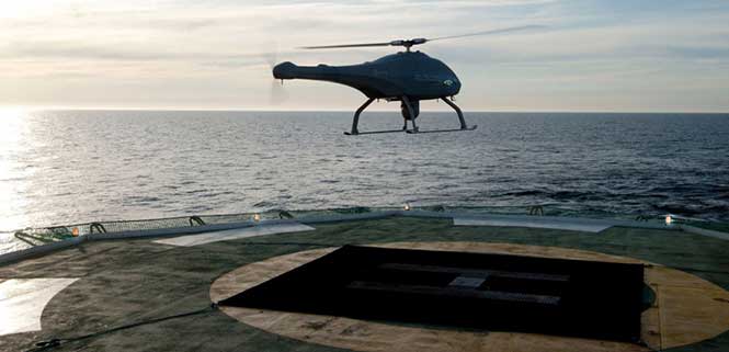
Drones are quickly becoming a staple of the maritime industry. In January, the European Maritime Safety Agency (EMSA) issued the largest ever civilian maritime drone contact, valued at €67 million.Under the contract, drones will be used to assist with border control, search-and-rescue operations and monitoring of pollution, as well as the detection of illegal fishing and drug and people trafficking.


External Vessel Inspections. Big names in the maritime industry such as DNV-GL, Lloyds Register and Maersk have all shown strategic intent to revolutionize their operations by embracing drone technology, and many maritime operators are now following suit.

All ship owners know that traditional methods of external vessel inspection can be a costly affair. Now that high-definition, camera-equipped drones are widely available and affordable, it is becoming more common to use them for external vessel inspections to assess structural conditions. Identifying substantial corrosion, significant deformation, fractures, damage or other structural deterioration can be done quickly, easily and cost-effectively using drones.

Tank Inspections. The visual inspection of cargo tanks was traditionally performed by workers suspended on ropes to inspect the tank structure. The sheer size of modern-day vessels means that access methods including staging, rafting and climbing are often used by surveyors to access tanks.

In contrast, drone surveys require no human access to the tank and, since no access equipment is required, there are no setup costs, and inspections can be completed within a quicker timeframe.

Bathymetric Surveys. Accurate and reliable information on the features of water bodies and their shorelines is vital to navigational safety. Bathymetric surveys gather the information, which is then published for use on nautical charts. Rather than using a fixed-wing airplane or helicopter, bathymetric sensors developed for drones allow this type of survey to be carried out flexibly and at a fraction of the cost.

To operate effectively in the harsh maritime environment, the technology has been developed to withstand storm force wind and heavy rain, snow and salt spray.
As technology advances, so does the flight time available on drones, meaning more area can be covered in a quicker timeframe.

Floating Flare-Tip Inspections. Drone surveys typically exist to provide close visual and thermal inspections of high, live or difficult to access structures offshore, and there’s nothing more challenging to access than a flare tip, 70 meters above water, on a floating production facility.

Drone survey inspections for flare tips remove the need for a shutdown to inspect the flare and offer reduced costs compared to aerial surveys carried out by helicopter or plane.

Offshore Wind Energy. The wind energy sector is growing fast. Storm force winds, erosion, lightning strikes and even build-up of insects can have an impact on turbines, and blades need to be inspected for deterioration. Inspectors have traditionally had to scale the turbines with the help of ropes and cables.


Source:
http://gpsworld.com/are-drones-the-future-of-marine-surveying/
Prev Next
This website stores cookies on your computer. These cookies are used to provide a more personalized experience and to track your whereabouts around our websitle in compliance with the European General Data Protection Reguation. If you decide to to op-out of any future tracking, a cookie will be setp in your browser to remember this choice for one year.
Accept
Deny