From autonomous machine control and geodetic surveying to infrastructure deformation monitoring and permanent reference station networks, modern positioning systems now achieve centimeter-level or even millimeter-level accuracy. Yet even the most advanced Global Navigation Satellite System (GNSS) receivers continue to face one persistent challenge: multipath interference.
Unlike signal blockage, which is immediately obvious when satellite visibility is poor, multipath errors are often far more difficult to identify because the receiver is still tracking signals that appear valid at first glance. In high-precision positioning environments, these reflected signals can quietly degrade measurement quality and introduce positioning inconsistencies that directly affect operational performance.
Challenge of GNSS Multipath Errors
GNSS positioning works by calculating the travel time of radio-frequency signals transmitted from satellites orbiting Earth. A receiver determines its position by measuring how long the signals take to arrive and then calculating the distances to multiple satellites simultaneously. Multipath interference occurs when the receiver tracks not only the direct signal transmitted from the satellite but also delayed copies of that signal that reflect off nearby surfaces.
Although these delays may seem extremely small, often measured in nanoseconds, even tiny timing errors can significantly distort positioning accuracy. In applications where survey engineers require centimeter-level precision, minor signal delays can quickly become major operational problems.
How Multipath Corrupts Positioning Data
Every GNSS receiver continuously measures signal arrival time with extraordinary precision. When a satellite signal reaches the receiver directly through an unobstructed path, distance calculations remain highly accurate. Problems begin when reflected signals arrive milliseconds later from surrounding objects after traveling a longer physical path.
The receiver may interpret these delayed signals as legitimate satellite transmissions, causing inaccurate distance calculations. Since GNSS positioning depends on combining measurements from multiple satellites simultaneously, even one corrupted signal can affect the final positioning solution.
Multipath interference affects two major types of GNSS measurements differently: Code Measurement and Carrier Phase Measurement
The first is code measurement, also known as pseudorange measurement. Code measurements are highly sensitive to reflected signals and can experience errors ranging from several meters to significantly larger deviations when severe signal reflection occurs.
The second is carrier phase measurement, which is used in high-precision positioning methods such as Real-Time Kinematic positioning. Carrier phase measurements are far more precise and generally more resistant to multipath compared with code measurements. However, under severe multipath conditions, reflected signals can still introduce phase distortion that degrades RTK initialization performance, increases ambiguity resolution time, and reduces overall positioning stability.
Common Culprits: Where Do GNSS Multipath Errors Occur?
Multipath interference is fundamentally an environmental problem.
Anthropogenic Environment
Whenever surrounding objects can reflect electromagnetic waves, the possibility of signal corruption increases. One of the most common examples occurs in dense urban environments. Engineers often refer to this phenomenon as the urban canyon effect, where tall buildings create narrow corridors that trap satellite signals.
Other statuses include glass curtain walls and steel structural components in the city, temporary machinery, cranes and metal scaffolding at construction sites
Natural Environment
Dense tree canopies, particularly broadleaf vegetation, scatter incoming GNSS signals in multiple directions before they reach the antenna. Forest surveying operations often experience degraded signal quality because reflected signals combine with weakened direct signals beneath heavy vegetation.
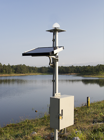
Bodies of water also create strong reflective surfaces. Calm lakes, reservoirs, wet ground surfaces, and even snow-covered terrain can reflect satellite signals upward toward the receiver, causing measurement distortion even when no nearby buildings are present.
Poor Antenna Placement Can Make Multipath Worse
In many cases, site selection itself becomes the first line of defense against multipath interference. Even highly sophisticated survey-grade receivers struggle when antennas are installed too close to reflective surfaces. The receiver can only process the signal environment presented to it. If reflected signals dominate the surrounding environment, positioning performance will inevitably degrade.
- One common mistake involves mounting antennas near metal fences or communication towers. Large metallic structures reflect strong electromagnetic signals that can easily interfere with direct satellite reception.
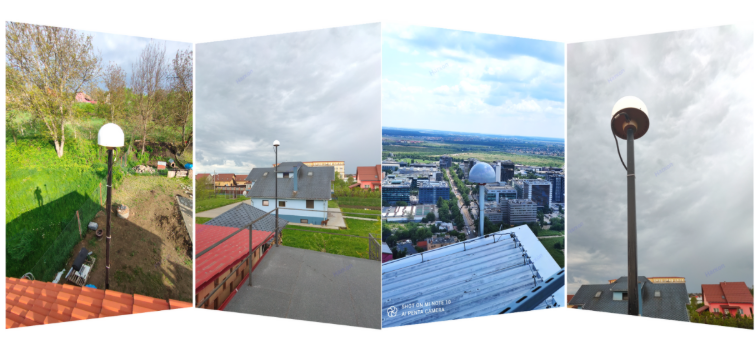
- Rooftop installations also present challenges. Survey equipment mounted near HVAC systems, air conditioning units, metal ventilation systems, or reflective rooftop surfaces often experiences unexpected positioning instability despite apparently good satellite visibility.
- Nearby walls can create similar issues. Flat concrete structures positioned close to the antenna can generate delayed reflections that continuously distort incoming signals.
- Temporary construction environments introduce another layer of complexity. Mobile machinery, steel containers, cranes, generators, and other temporary structures constantly change the surrounding reflective environment, making signal conditions highly unpredictable.
Proper installation practices include selecting open-sky locations, maximizing distance from reflective surfaces, minimizing nearby obstructions, and carefully evaluating the surrounding environment before deploying the system.
Software Mitigation vs Hardware Necessity
Modern GNSS receiver technology has significantly improved the ability to reduce multipath-related positioning errors.
- Advanced receivers now track multiple satellite constellations simultaneously, including GPS, GLONASS, Galileo, and BeiDou. Access to more satellites allows positioning algorithms to compare more observations and reduce dependence on potentially corrupted signals.
- Dual-frequency and multi-frequency processing have also improved resilience. Signals transmitted on different frequencies interact differently with environmental interference, allowing receivers to compare signal behavior and improve measurement confidence.
- Many modern systems additionally use Signal-to-Noise Ratio filtering. Signals with unusually weak strength or abnormal noise characteristics can be automatically deprioritized during position calculation.
- Advanced RTK engines further analyze carrier phase consistency, filtering measurements that do not meet expected quality thresholds.
These software-based mitigation strategies have dramatically improved positioning performance across challenging environments.
However, software-based filtering has one unavoidable limitation. Algorithms can reject corrupted data after the signal enters the system, but software cannot physically prevent reflected signals from reaching the antenna itself. Once signal contamination occurs at the antenna level, receiver software is forced to work with imperfect input data. This creates a fundamental limitation in severe multipath environments where reflected signals consistently overwhelm clean satellite reception.
Hardware Solutions: Role of Choke Ring Antennas
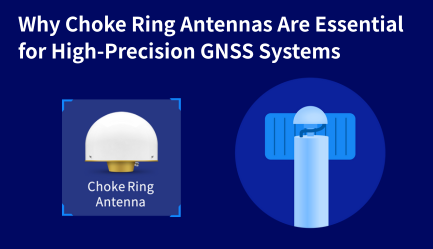
When GNSS deployments operate in environments where multipath interference cannot be fully avoided, hardware design becomes increasingly important. This is where choke ring antennas play a critical role.
Unlike standard GNSS antennas that primarily focus on signal-reception sensitivity, choke-ring antennas are engineered to reduce low-angle reflected signals before they reach the antenna element.
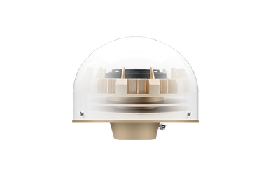
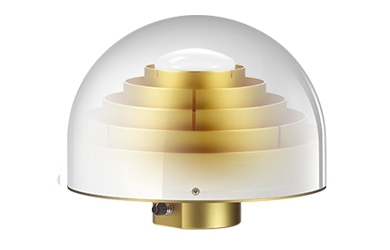
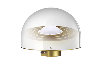
Their distinctive physical design incorporates multiple concentric conductive rings surrounding the central receiving element. These precisely engineered rings act as passive electromagnetic barriers. Direct satellite signals arriving from above pass through normally and reach the receiving element with minimal disruption.
Reflected signals behave differently. Since multipath signals typically arrive at the antenna from low elevation angles near the horizon, the concentric ring structure physically traps and dissipates these reflected waves before they can interfere with signal processing. This allows the receiver to work with a significantly cleaner signal environment.
Unlike software filtering, which attempts to remove corrupted data after reception, choke ring antennas reduce signal contamination at the source. This is precisely why choke ring antennas remain widely deployed in permanent reference station infrastructure, geodetic monitoring systems, scientific observation networks, and other mission-critical positioning applications where signal integrity cannot be compromised.
Manufacturers such as Harxon continue to develop specialized GNSS antenna solutions designed for environments where multipath mitigation directly impacts positioning reliability.
Frequently Asked Questions About GNSS Multipath Errors
What causes GNSS multipath interference?
Multipath occurs when satellite signals reflect off surrounding surfaces, such as buildings, metal structures, water, or vegetation, before reaching the receiver antenna.
Does RTK completely eliminate multipath errors?
No. RTK significantly improves positioning accuracy, but severe multipath interference can still degrade carrier-phase measurements and reduce solution stability.
Can software fully remove multipath errors?
Software can filter suspicious or low-quality measurements, but it cannot physically prevent reflected signals from reaching the antenna.
Why are choke ring antennas effective in multipath environments?
Their concentric-ring structure suppresses low-elevation reflected signals before they reach the receiver, improving signal purity at the hardware level.
Where are GNSS multipath problems most common?
Multipath frequently occurs in urban environments, construction sites, near metal structures, beneath tree canopies, around water surfaces, and on reflective rooftops.
Conclusion
Multipath interference remains one of the most difficult challenges in high-precision GNSS positioning. Managing this problem requires a layered approach rather than reliance on a single solution.
Proper antenna placement reduces environmental reflection risks, advanced receiver software helps identify suspicious measurements, and multi-frequency signal processing improves measurement confidence. By combining careful installation practices with advanced receiver technology and specialized hardware, such as choke-ring antennas, professionals can significantly improve positioning stability and maintain the reliable, high-precision GNSS performance required for demanding surveying, monitoring, and reference-station applications.